Study Context
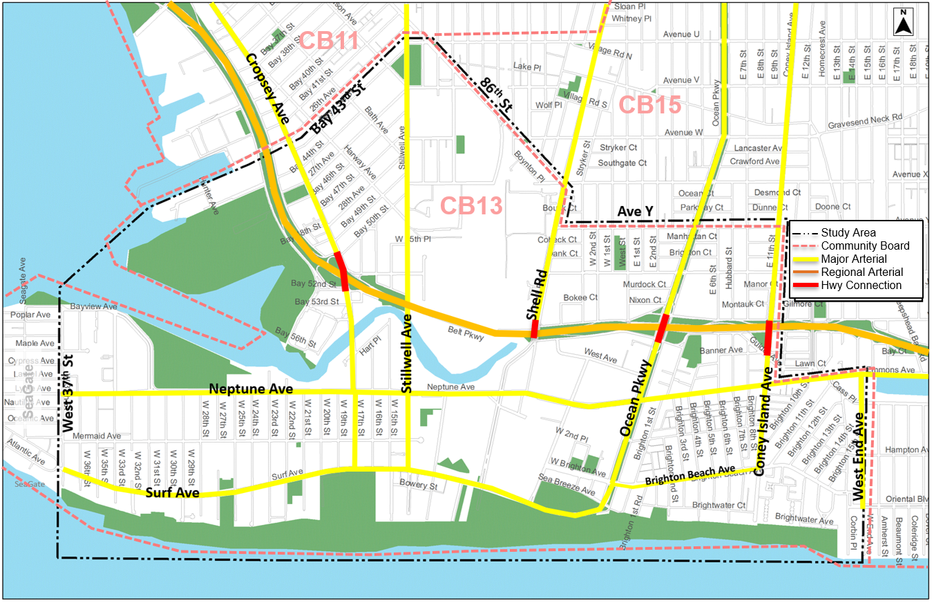
The Coney Island area with its beaches, amusement parks and recreational facilities have long attracted significant summer traffic. This in conjunction with rezoning actions facilitating increased development density and a rapidly growing residential population contribute to congestion, high parking demand and other transportation related challenges for residents of this south Brooklyn neighborhood. The challenges highlight the need for exploring different approaches such as travel demand management (TDM). Coney Island is currently undergoing significant land use changes as a result of the Department of City Planning’s (NYCDCP) 2009 rezoning. Following decades of population decline, many new developments are recently opened, planned or underway with more than 5,000 dwelling units on eight development sites by 2031. The demographic changes are also significant as the senior population has grown steadily in CD13 which now has the highest percentage of over-65 population in NYC. This segment of the population can have very different travel needs. The area also has a concentration of persons with disabilities and limited English proficiency (LEP) higher than the NYC average which makes accessibility and mobility for all a priority. Additionally, the 2021 NYCDOT Streets Plan identifies the west half of the study area as a priority 1 investment area (PIA) based upon demographic characteristics, job and residential density and previous agency investment levels.
The growing travel demand and increased trips to and from the area is evidenced in congestion, and community complaints about congestion and safety on the street network. Major arterials providing access to the area, such as the Belt Parkway, are often congested with entrance and exit ramps backed up onto arterials and the local streets. From a community board perspective, Community Board 13 (CB13) Statement of Community District Needs has consistently ranked “traffic” as one of their three most pressing issues. From a safety perspective the Vision Zero (VZ) initiative has identified eight priority intersections and seven priority corridors in the proposed study area where efforts will be focused.
Against this backdrop, the Coney Island Transportation Study is being conducted to identify and define traffic/transportation issues through an on-going, robust public outreach/public participation process and comprehensive data collection and analysis. The study will make recommendations to improve existing and future travel and traffic conditions focusing on accessibility, parking, enhancing/promoting alternative modes and safety for all street users in the Coney Island area.


