Charter tour buses illegally parking in a Top View stop blocking the bike lane here.
The NYC Truck Route Network is a system of designated roads that helps commercial vehicles navigate the city efficiently. It aims to:
Connect primary freight origins and destinations.
Maximize access to industrial and commercial zones.
Minimize conflicts with residential areas and vulnerable road users.
This network is crucial for supporting the local economy and livability by:
Organizing neighborhood truck activity
Reducing traffic congestion on non-designated routes
Feedback Guidance:
We want to hear from you, help us identify how and where we can improve the movement of trucks on our city streets.
Options for feedback:
 Confusing Truck Route Signage: A Unclear or inaccurate posted truck route signage
 Missing Truck Route Signage: A lack of adequate signage to help guide trucks to and along designated truck routes.
 Poor network connection: Areas with inadequate truck route network connectivity, often leading truck drivers to deviate from designated truck routes.
 Weight & Height Restrictions: Overweight and/ or over-dimensional trucks are often observed.
 Limited Curb Access: Trucks observed blocking moving, bike, or bus lanes; or have limited access to curbs for loading and unloading purposes.
 Narrow Roadway: Limitations by the physical characteristics of the street, such as narrow roadway
 Difficult Truck Turn: Limitations by the physical characteristics of the street, such as sharp turns
 Maintenance Needed: Substandard road conditions, such as potholes, uneven surfaces, or lack of maintenance.
 Limited Truck Parking: Shortage of designated parking spaces for trucks.
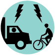
 Observed Bicyclist and Truck Conflict: Observed locations where multiple incidents of bicycle and truck conflicts occurred
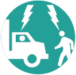
 Observed Pedestrian and Truck Conflict: Observed locations where multiple incidents of pedestrian and truck conflicts occurred
 Speeding Truck: Locations where trucks are observed speeding along the street or intersection
 Health and Environmental Impact: Locations with air quality, general health, and environmental concerns

Charter tour buses illegally parking in a Top View stop blocking the bike lane here.

Charter tour buses illegally park in the safety zones. They drop off passengers, wait for 30-60 min until pick up, or take a left turn onto Front St. to wait and park in the Top View bus lane, which the company is not using, blocking the bike lane. On the opposite side of Front street is the end of line MTA bus stop. And then there is the parade of school buses going to and from Dock Street. Plus, all manner of trucks are trying to get past the charter buses parked at York. The curb is broken here. Opposite York Street is also a parking garage, and between all of these commuter interests, plus the backup caused by buses trying to turn off Front onto Main street, creates a large chokehold.

This is a very busy intersection, filled with pedestrians and bicycles, just a few feet from many bars and restaurants and nearby Barclay Center. It is an exceptionally unsafe condition to allow trucks. Also, it is an anomaly to allow trucks on residential blocks in Brownstone Brooklyn - in fact Bergen Street between 5th Ave and 3rd Ave is the only street in the area where this is sanctioned. With the construction of the large residential project on the North side of Bergen between 3rd and 4th, these unsafe and exceptionally crowded and noisy conditions will only get worse. These blocks are also critical components of the city-bound bike infrastructure, with dozens of Citibike docking stations nearby. They are also used by the morning Bergen Street Bike Train for Kids. And furthermore, why do trucks even need to use these blocks? Please don't wait for a study to be completed to make this important change, before another person gets hurt or worse.

The sidewalks are too narrow and trucks double park which causes pedestrians to walk into the street into traffic. This is a bus station hub and Marcy Ave subway station sees a lot of pedestrians volume. The sidewalk needs to be widened in the east side of Havenmeyer. Remove the parking and extend the sidewalk.

Northbound trucks face conflict with cyclists at this intersection

Two way cycle flow should continue east on flushing there is no safe place for cyclists to cross under the BQE. The NW corner of this intersection gets crowded with trucks in the crosswalk/bike lanes.

Large trucks speed to make this light. The area has high cyclists and pedestrians volumes. While the new bike lane is nice it is not enough. Trucks (including city owned vehicles) park and idle illegally here. Cars also regularly drive to the green painted bike path to get around double parked cars. Closing the on ramp at Roebling and connections Continental Army Plaza with LaGuardia Playground should be a priority.

Trucks idle and double park. There is a school and elder care facility here it is not conducive for semi trucks. This truck route should be considered a priority for removal.

Trucks often speed down this street. This street is a fire route and a bus route, it should not also be a “truck” route. Trucks should be on streets with speed bumps to prevent them from speeding. City buses tend not to speed, and fire trucks have to speed. Trucks should not be given the opportunity to speed.

Trucks speed down 9th St like they’re still on the freeway, ignoring pedestrian and cyclist right of way, driving on the bike lane and in several cases taking turns way too fast onto the road and running over the permanent jersey barriers
Comments should be related to the posted topic or specific project. The Projects and Initiatives website is not meant for comments that do not directly relate to the purpose or topic of the specific project. For general comments or communications concerning an agency, please contact the agency's Commissioner on www.NYC.gov. For service requests, please contact 311 Online.
Pan left or rigth to show the area you wish to comment on.
To add your comments:
How do you want to submit your comment: