
The New York City Truck Route Network plays a major role in the city's extensive freight infrastructure. Its purpose is to connect major freight origins and destinations seamlessly, facilitating efficient access to industrial and commercial areas while safeguarding against conflicts with land uses and vulnerable road users.
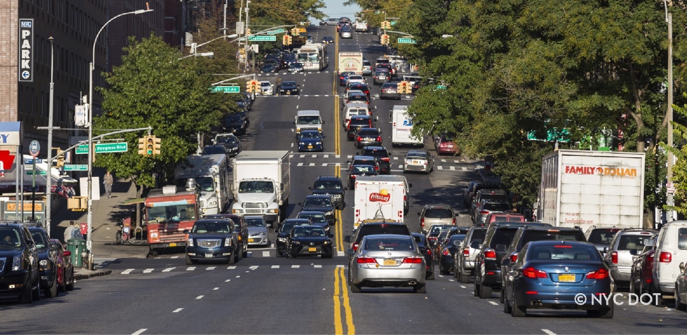
Close to 90% of NYC’s goods are moved into and around the city by truck. Increased demand for deliveries to our homes and businesses has resulted in more trucks on our roads, creating environmental and safety risks. Delivering New York: A Smart Truck Management Plan for New York City and Delivering Green: A vision for a sustainable freight network serving New York City highlight the critical work needed to execute New York City’s shared vision for the future of safer, more efficient, and sustainable freight movement.
How Goods Move Through New York City
Established in the 1970s, the Truck Route Network is critical in connecting commercial vehicles to major freight hubs, maximizing access to industrial and commercial zones while minimizing conflicts with residential land uses and vulnerable road users.
How the Truck Route Network Works
All vehicles defined as a truck (two axles and six tires, or three or more axles) are required to follow the Truck Route Network. Commercial vehicles that do not meet the definition of a truck are not required to follow this network but must follow all posted signage regarding the operation of commercial vehicles.
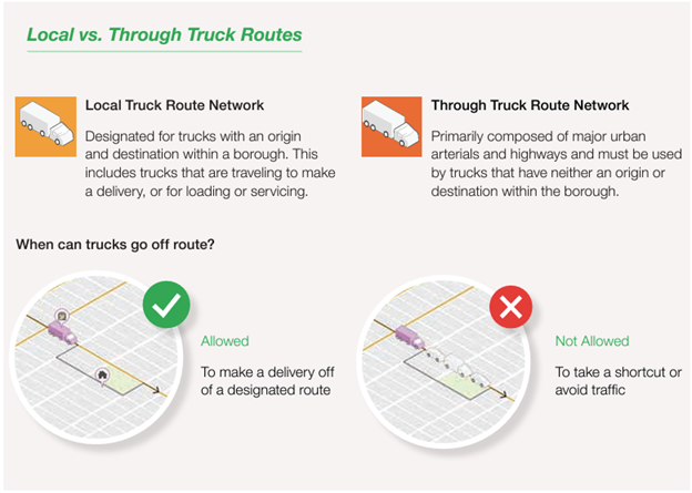
The truck route network is primarily comprised of two distinct route classes: Local Truck Routes and Through Truck Routes. Local Truck Routes are designated for trucks with an origin or destination within the same borough. This includes trucks that are traveling to make a delivery, or for loading or servicing. Where origins or destinations are not directly on truck routes, trucks may go off-route for the minimum distance required to get to their destinations.
Through Truck Routes consist of major urban arterials and highways and must be used by trucks that have neither an origin nor destination within the borough. Each truck must comply with the weight and length rules for commercial vehicles. Within Staten Island, certain roadways are also designated as Limited Local Truck Routes. These serve as local routes but are limited to trucks with two axles and six tires.
New York City truck routes have a complex mixture of abutting land uses. On average, 32% of the parcels along truck routes are industrial, commercial, and mixed-use. DOT uses these land use types as a guide when selecting new truck routes. DOT seeks, where possible, to provide straight line routes with short travel times on wide streets with generous turn geometry and where there is existing truck usage. DOT also tries to avoid low clearance structures, residential land uses, narrow streets with tight turn geometry, and congestion. However, 53% of all parcels along truck routes are strictly residential, so avoiding residential areas is not always achievable.
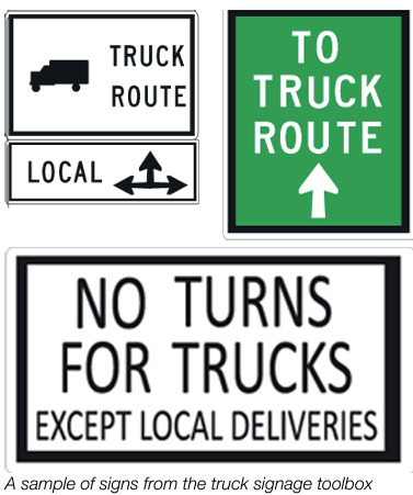
The official marker of truck routes on city streets are black and white regulatory signs, which are installed at intersecting truck routes. These regulatory signs help to keep truck drivers on-route and indicate legal options for different directions of travel. In some major industrial areas like Hunts Point and Maspeth, these signs are supplemented by green wayfinding signs providing additional directional guidance to truck drivers. Alternatively, prohibitive signs are used sparingly in residential areas that are having unusual issues with off-route trucks.
Redesign the Truck Route Network
As part of the city’s comprehensive freight strategy, DOT is working to keep up with changes in residential and commercial land use patterns, the transportation network, reduce network redundancies, and adapt to changing delivery patterns, the city recognized the need for an update to address several key factors:
-
Enhanced Efficiency: As the city's economy continues to grow and evolve, there is a pressing need to optimize the efficiency of freight movement. A redesign of the Truck Route Network will streamline the flow of goods, reducing congestion and improving overall productivity.
-
Safety Considerations: The redesigned network aims to enhance safety for all road users by minimizing conflicts with residential areas and vulnerable road users. The risk of crashes and road-related incidents will be mitigated by rerouting truck traffic away from densely populated neighborhoods and sensitive areas such as schools, daycare centers, hospitals, senior centers, playgrounds, parks, and bicycle lanes/pedestrian walkways.
-
Community Engagement: Recognizing the importance of community input and involvement, the truck route redesign process will prioritize engagement with stakeholders, including residents, businesses, and advocacy groups. Your feedback is crucial in shaping a network that effectively balances the needs of freight movement with community well-being and safety. By gathering feedback and addressing community concerns, the redesigned Truck Route Network aims to address the needs of all New Yorkers.
Shaping the Future of Freight Movement: How You Can Contribute
We are committed to a collaborative approach in this effort.
Comments were submitted on our interactive map -[Feedback for the Truck Route Network Redesign].
Deadline for comments were on July 31, 2024.