Truck traffic is a major problem on Kingsland Avenue, and connecting to Woodpoint Avenue.
The NYC Truck Route Network is a system of designated roads that helps commercial vehicles navigate the city efficiently. It aims to:
Connect primary freight origins and destinations.
Maximize access to industrial and commercial zones.
Minimize conflicts with residential areas and vulnerable road users.
This network is crucial for supporting the local economy and livability by:
Organizing neighborhood truck activity
Reducing traffic congestion on non-designated routes
Feedback Guidance:
We want to hear from you, help us identify how and where we can improve the movement of trucks on our city streets.
Options for feedback:
 Confusing Truck Route Signage: A Unclear or inaccurate posted truck route signage
 Missing Truck Route Signage: A lack of adequate signage to help guide trucks to and along designated truck routes.
 Poor network connection: Areas with inadequate truck route network connectivity, often leading truck drivers to deviate from designated truck routes.
 Weight & Height Restrictions: Overweight and/ or over-dimensional trucks are often observed.
 Limited Curb Access: Trucks observed blocking moving, bike, or bus lanes; or have limited access to curbs for loading and unloading purposes.
 Narrow Roadway: Limitations by the physical characteristics of the street, such as narrow roadway
 Difficult Truck Turn: Limitations by the physical characteristics of the street, such as sharp turns
 Maintenance Needed: Substandard road conditions, such as potholes, uneven surfaces, or lack of maintenance.
 Limited Truck Parking: Shortage of designated parking spaces for trucks.
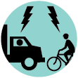
 Observed Bicyclist and Truck Conflict: Observed locations where multiple incidents of bicycle and truck conflicts occurred
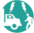
 Observed Pedestrian and Truck Conflict: Observed locations where multiple incidents of pedestrian and truck conflicts occurred
 Speeding Truck: Locations where trucks are observed speeding along the street or intersection
 Health and Environmental Impact: Locations with air quality, general health, and environmental concerns

Truck traffic is a major problem on Kingsland Avenue, and connecting to Woodpoint Avenue.

DOT should conduct an air quality survey for PS 132 to see how the constant truck traffic on Metropolitan is affecting the air quality around the elementary school. Particulate matter particles less than 2.5 micrometers in diameter, also known as fine particles or PM2.5, pose the greatest risk to health. And guess what is a major contributor of PM2.5? Diesel exhaust from heavy duty trucks/tractor trailers. Please help us reduce the truck traffic on Metropolitan corridor to improve our air quality and overall health. https://www.lung.org/getmedia/f6fbd6cd-328c-4a64-9d02-72dbee3550d8/truck-corridors_FINAL_083022_noAppendices.pdf

Every morning there is bumper to bumper tractor trailer trucks traveling from the industrial section of East Williamsburg/Queens through to (I imagine) the BQE entrance. The sheer volume and size of the trucks on Metropolitan is completely out of hand and is a danger and health hazard to the many residents on and around this street, not to mention the small businesses and the ELEMENTARY SCHOOL CHILDREN at PS 132.

Trucks (and cars) making the left from Hicks onto Atlantic (to get on the BQE) NEVER yield to pedestrians in the crosswalk on the west side of Hicks. I do not cross the street here ever anymore as it is so dangerous. I recently saw a jogger in the cross walk having to jump out of the way to avoid behind hit (while 2 NYPD traffic cops standing at the NW corner of Atlantic and Hicks) watched and said absolutely nothing.

Because of the long line of traffic to get onto the BQE, trucks regularly block this intersection and crosswalk, forcing pedestrians to have to weave through traffic. I have seen a number of near accidents, particularly with children going to and from school, as they have to leave the crosswalk to cross Atlantic, leading to them nearly getting hit by southbound traffic on Henry or eastbound traffic on Atlantic.

Because of the long line of traffic to get onto the BQE, trucks regularly block this intersection and crosswalk, forcing pedestrians to have to weave through traffic. I have seen a number of near accidents, particularly with children going to and from school, as they have to leave the crosswalk to cross Atlantic, leading to them nearly getting hit by northbound traffic on Clinton or eastbound traffic on Atlantic.

There is a crosswalk here. There are no signs warning cars or trucks about the stop sign. Traffic is always backed up as cars (who are bypassing the BQE) wait to turn left on Atlantic to get on the BQE. There is rarely a backup in the right hand lane. When a truck is in middle lane, it blocks the view of cars in the right hand lane of anyone using the crosswalk coming from the dog park. I have been nearly hit by cars going through the stop walk too many times to count. There was a stop sign here (that was regularly ignored), but at least it was something. Apaprently, that was meant to temporary for construction at the SW corner of Atlantic and Hicks. Because there is a stop work order and no construction work has been preformed in years, DOT has claimed the stop sign should not be put back up until construction resumes. However, even though there is not active construction going on, the scaffolding remains up which blocks the sidewalk on the west side of Hicks. Whereas one could previously safely cross Hicks at Atlantic and use this sidewalk on the west side, there is now no way to avoid risking your life crossing at the crosswalk at Pacific.

Crossing Atlantic from Court Street is dangerous whether from trucks or any vehicle. The left turn signal from Atlantic to Court creates an especially dangerous scenario for pedestrians who decide to cross thinking all traffic is turning left when in fact the west bound lane next to the turn lane has a green light to continue straight. Vehicles barrel through the green light.

I commute to work by bicycle. Crossing Atlantic from Henry going south can be dangerous, especially and increasingly 5:30-7pm, when there is sometimes gridlock on Atlantic forcing cyclists and pedestrians to weave between vehicles blockin the box.

This commercial stretch of Lafayette Avenue is inundated with double parking from trucks and therefore the buffered bike lane is consistently blocked. The bike lane should be upgraded to a parking protected bike lane.
Comments should be related to the posted topic or specific project. The Projects and Initiatives website is not meant for comments that do not directly relate to the purpose or topic of the specific project. For general comments or communications concerning an agency, please contact the agency's Commissioner on www.NYC.gov. For service requests, please contact 311 Online.
Pan left or rigth to show the area you wish to comment on.
To add your comments:
How do you want to submit your comment: