Projects and Initiatives Site Policy
Customer Use Policy
Please be aware that when engaging with the New York City Department of Transportation (“NYCDOT”) via the Projects and Initiatives website, you are agreeing to the following:
Commenting on the NYCDOT Projects and Initiatives Site
Comments made by the public to the Projects and Initiatives site are reviewed and, while comments will not be edited by NYCDOT personnel, a comment may be blocked if it violates the comment policy described here.
- Comments should be related to the posted topic or specific project. The Projects and Initiatives website is not meant for comments that do not directly relate to the purpose or topic of the specific project. For general comments or communications concerning an agency, please contact the agency's Commissioner on www.NYC.gov. For service requests, please contact 311 Online.
- You are subject to the Terms of Service (TOS) of the host site. Content you share with or post to the Projects and Initiatives website is subject to the TOS of the host site and may be used by the owners of the host site for their own purposes. For more information, consult the host website's TOS.
- The Projects and Initiatives website is not open to comments promoting or opposing any person campaigning for election to a political office, or promotion or advertisement of a business or commercial transaction.
- The use of obscene, threatening or harassing language is prohibited.
- Personal attacks of any kind or offensive comments that target or disparage any ethnic, racial, age, or religious group, gender, sexual orientation or disability status are prohibited.
- Comments advocating illegal activity or posting of material that violates copyrights or trademarks of others are prohibited.
- This comment policy is subject to amendment or modification at any time.
User Created Content
Users are welcome to submit or post content to an official New York City site where the agency allows users to post content, the content meets the standards articulated in this Customer Use Policy and pertains to the subject of the social media site. Users may only post their own, original content. Reproduced or borrowed content that reasonably appears to violate third party rights will be deleted.
Reasonable Accommodation
To request a reasonable accommodation when accessing New York City social media sites, please contact NYCDOT’s ADA Coordinator by calling 212-839-6428 or emailing accessibility@dot.nyc.gov.
Questions or Concerns
Questions or concerns regarding NYCDOT’s Projects and Initiatives activity, NYCDOT’s Projects and Initiatives Site Policy and/or this Customer Use Policy should be submitted online.

 Confusing Truck Route Signage: A Unclear or inaccurate posted truck route signage
  Missing Truck Route Signage: A lack of adequate signage to help guide trucks to and along designated truck routes.
  Poor network connection: Areas with inadequate truck route network connectivity, often leading truck drivers to deviate from designated truck routes.
  Weight & Height Restrictions: Overweight and/ or over-dimensional trucks are often observed.
  Limited Curb Access: Trucks observed blocking moving, bike, or bus lanes; or have limited access to curbs for loading and unloading purposes.
  Narrow Roadway: Limitations by the physical characteristics of the street, such as narrow roadway
 Difficult Truck Turn: Limitations by the physical characteristics of the street, such as sharp turns
 Maintenance Needed: Substandard road conditions, such as potholes, uneven surfaces, or lack of maintenance.
  Limited Truck Parking: Shortage of designated parking spaces for trucks.
 Observed Bicyclist and Truck Conflict: Observed locations where multiple incidents of bicycle and truck conflicts occurred
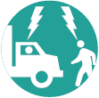
 Observed Pedestrian and Truck Conflict: Observed locations where multiple incidents of pedestrian and truck conflicts occurred
  Speeding Truck: Locations where trucks are observed speeding along the street or intersection
  Health and Environmental Impact: Locations with air quality, general health, and environmental concerns
  Comments (
 Comments (
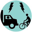


 Submit comments
 Return to map
To add your comments:
How do you want to submit your comment: