trucks and cars frequently wait in contra flow bike lane which provides access to bk bridge for cyclists due to inadequate protection of bike lane and inadequate short duration parking/loading in the area and non existing enforcement of parking regs
The NYC Truck Route Network is a system of designated roads that helps commercial vehicles navigate the city efficiently. It aims to:
Connect primary freight origins and destinations.
Maximize access to industrial and commercial zones.
Minimize conflicts with residential areas and vulnerable road users.
This network is crucial for supporting the local economy and livability by:
Organizing neighborhood truck activity
Reducing traffic congestion on non-designated routes
Feedback Guidance:
We want to hear from you, help us identify how and where we can improve the movement of trucks on our city streets.
Options for feedback:
 Confusing Truck Route Signage: A Unclear or inaccurate posted truck route signage
 Missing Truck Route Signage: A lack of adequate signage to help guide trucks to and along designated truck routes.
 Poor network connection: Areas with inadequate truck route network connectivity, often leading truck drivers to deviate from designated truck routes.
 Weight & Height Restrictions: Overweight and/ or over-dimensional trucks are often observed.
 Limited Curb Access: Trucks observed blocking moving, bike, or bus lanes; or have limited access to curbs for loading and unloading purposes.
 Narrow Roadway: Limitations by the physical characteristics of the street, such as narrow roadway
 Difficult Truck Turn: Limitations by the physical characteristics of the street, such as sharp turns
 Maintenance Needed: Substandard road conditions, such as potholes, uneven surfaces, or lack of maintenance.
 Limited Truck Parking: Shortage of designated parking spaces for trucks.
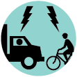
 Observed Bicyclist and Truck Conflict: Observed locations where multiple incidents of bicycle and truck conflicts occurred
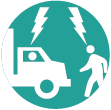
 Observed Pedestrian and Truck Conflict: Observed locations where multiple incidents of pedestrian and truck conflicts occurred
 Speeding Truck: Locations where trucks are observed speeding along the street or intersection
 Health and Environmental Impact: Locations with air quality, general health, and environmental concerns

trucks and cars frequently wait in contra flow bike lane which provides access to bk bridge for cyclists due to inadequate protection of bike lane and inadequate short duration parking/loading in the area and non existing enforcement of parking regs

inadequate curb access on side streets trucks block dedicated bus lanes on fulton to make deliveries to fulton mall businesses significantly delaying buses

inadequate curb access on side streets trucks block dedicated bus lanes on fulton to make deliveries to fulton mall businesses significantly delaying buses

inadequate curb access on side streets trucks block dedicated bus lanes on fulton to make deliveries to fulton mall businesses significantly delaying buses

inadequate curb access on side streets trucks block dedicated bus lanes on fulton to make deliveries to fulton mall businesses significantly delaying buses

inadequate curb access on side streets trucks block dedicated bus lanes on fulton to make deliveries to fulton mall businesses significantly delaying buses

inadequate curb access on side streets trucks block dedicated bus lanes on fulton to make deliveries to fulton mall businesses significantly delaying buses

inadequate loading zones in adjacent streets cause trucks to block bike lanes in both directions to make deliveries to hotels on this block

bad intersection timing and design causes truck pedestrian conflict on north crosswalk across flatbush for left turn. all schermerhorn traffic should be routed to flatbush north via currently closed 3av stub. all 3av traffic should go to lafayette with a lane and separate signal in lieu of curb parking to follow closed 3av stub to flatbush north. during main red phase of flatbush eastbound bike traffic can continue through the intersection between left only schermerhorn traffic bound for flatbush and right only traffic 3av to lafayette. during brief 3 av to flatbush phase, eastbound bike traffic would stop. schemerhorn to lafayette traffic would follow state street to flatbush instead. signal at state required

extensive double parking causes conflict between bicycle traffic and motor vehicle traffic. loading zones and docks are not properly used. protected bike lane should be extended as it is north of lafayette and ashland should run south only here to reduce opposing traffic conflicts if loading zones are oversubscribed. bike traffic need to be two way here for manhattan bridge-4th ave connectivity.
Comments should be related to the posted topic or specific project. The Projects and Initiatives website is not meant for comments that do not directly relate to the purpose or topic of the specific project. For general comments or communications concerning an agency, please contact the agency's Commissioner on www.NYC.gov. For service requests, please contact 311 Online.
Pan left or rigth to show the area you wish to comment on.
To add your comments:
How do you want to submit your comment: