Scary corner. Too many trucks don't see pedestrians crossing. Heavy foot traffic.
The NYC Truck Route Network is a system of designated roads that helps commercial vehicles navigate the city efficiently. It aims to:
Connect primary freight origins and destinations.
Maximize access to industrial and commercial zones.
Minimize conflicts with residential areas and vulnerable road users.
This network is crucial for supporting the local economy and livability by:
Organizing neighborhood truck activity
Reducing traffic congestion on non-designated routes
Feedback Guidance:
We want to hear from you, help us identify how and where we can improve the movement of trucks on our city streets.
Options for feedback:
 Confusing Truck Route Signage: A Unclear or inaccurate posted truck route signage
 Missing Truck Route Signage: A lack of adequate signage to help guide trucks to and along designated truck routes.
 Poor network connection: Areas with inadequate truck route network connectivity, often leading truck drivers to deviate from designated truck routes.
 Weight & Height Restrictions: Overweight and/ or over-dimensional trucks are often observed.
 Limited Curb Access: Trucks observed blocking moving, bike, or bus lanes; or have limited access to curbs for loading and unloading purposes.
 Narrow Roadway: Limitations by the physical characteristics of the street, such as narrow roadway
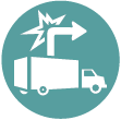
 Difficult Truck Turn: Limitations by the physical characteristics of the street, such as sharp turns
 Maintenance Needed: Substandard road conditions, such as potholes, uneven surfaces, or lack of maintenance.
 Limited Truck Parking: Shortage of designated parking spaces for trucks.
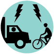
 Observed Bicyclist and Truck Conflict: Observed locations where multiple incidents of bicycle and truck conflicts occurred
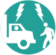
 Observed Pedestrian and Truck Conflict: Observed locations where multiple incidents of pedestrian and truck conflicts occurred
 Speeding Truck: Locations where trucks are observed speeding along the street or intersection
 Health and Environmental Impact: Locations with air quality, general health, and environmental concerns

Scary corner. Too many trucks don't see pedestrians crossing. Heavy foot traffic.

I truly believe that you can achieve all that you want to achieve regarding ‘connecting’ with pedestrians and the drivers of both, cars, truck drivers, scooters, bikers and hikers. 3D technology fans. Cheap ones for the attendants that are directing traffic now with the ancient Signages that no one even sees. /connected to that pole that they hold now, but one that spins that leaves a better resolute impression stupid/simple messages good for all the persons that are riding on fast wheels bicycles etc as well. for the road, the higher end 3D fans that can get a point across from a distance. Ultimately it is about, displaying the same thing in a newer fashion to entice the now faster Brains. Before overpasses for the truck drivers to notice; and drivers, and slowly everyone transits to the new ‘message display system’. If you saw value in this. Cheap/basic 3D fans for the poles

Metropolitan Ave - Speeding and loud trucks all day and all night. Extremely dangerous and loud

This is too much for our health and safety, I risk my life everyday on my bike and it’s so loud and smoggy.

A very dangerous intersection for pedestrians and cyclists (a moped driver was recently killed here). There is no crosswalk on the east side, there is no LPI, and trucks are coming from both sides of Kingsland, with most of them turning since it is a one way and a dead end. Also there is no signal to turn left onto Kingsland so a lot of trucks are there waiting for the yellow as other vehicles barell down the bridge at high speeds. Late turning vehicles makes it more difficult for pedestrians to cross Greenpoint ave (as well as bikes to turn left from Kingsland to the bridge).

After the construction of the recently completed Fed-Ex facility here, DOT got rid of an exiting sidewalk. There is now no sidewalk on either side of the street, and no markings on the extra large intersection which encourages speeding and trucks to not stop. So pedestrians have to walk in a large uncontrolled street with no markings or crosswalks.

This is an incredibly dangerous place to navigate as a pedestrian, bicyclist, and even driver in a small car. Heading eastbound to the LIE there are two lanes, with an unprotected "bike lane" in the middle as you approach the LIE. A lot of cars and trucks do not respect the "bike lane" and either turn from the left lane onto the LIE or try to cut ahead of the right turn lane and then cut back last minute. Also there is parking in the right lane after Bradley ave so all trucks/cars have to cross over the bike lane regardless. Pedestrians should have a LPI at the LIE as well because there is bad visibility from cars/trucks turning to get on LIE. Very very dangerous.

All traffic is forced to turn right. The turn is too tight and makes it very difficult for everyone to navigate. Often trucks end up on the curb with their rear tires, so pedestrians and bicyclists are put in harms way. Also it is not a truck route but tons of trucks take Greenpoint Ave to Starr (when heading towards Brooklyn).

Trucks are constantly stuck here and unable to make the turn. Their attempts have led to traffic jams, damaged cars and undue noise from horns blaring

Trucks constantly try to turn here, but very frequently get stuck and back up traffic. While this is an industrial area, primarily, many people live on this corner and the honking and back ups are horrible.
Comments should be related to the posted topic or specific project. The Projects and Initiatives website is not meant for comments that do not directly relate to the purpose or topic of the specific project. For general comments or communications concerning an agency, please contact the agency's Commissioner on www.NYC.gov. For service requests, please contact 311 Online.
Pan left or rigth to show the area you wish to comment on.
To add your comments:
How do you want to submit your comment: