

Limited Truck Parking
06/23/2024 - 12:10
Van Brunt St - Dikeman St - Coffey St
Several food trucks have been observed idling for more than 20 minutes.
Street View
The NYC Truck Route Network is a system of designated roads that helps commercial vehicles navigate the city efficiently. It aims to:
Connect primary freight origins and destinations.
Maximize access to industrial and commercial zones.
Minimize conflicts with residential areas and vulnerable road users.
This network is crucial for supporting the local economy and livability by:
Organizing neighborhood truck activity
Reducing traffic congestion on non-designated routes
Feedback Guidance:
We want to hear from you, help us identify how and where we can improve the movement of trucks on our city streets.
Options for feedback:
 Confusing Truck Route Signage: A Unclear or inaccurate posted truck route signage
 Missing Truck Route Signage: A lack of adequate signage to help guide trucks to and along designated truck routes.
 Poor network connection: Areas with inadequate truck route network connectivity, often leading truck drivers to deviate from designated truck routes.
 Weight & Height Restrictions: Overweight and/ or over-dimensional trucks are often observed.
 Limited Curb Access: Trucks observed blocking moving, bike, or bus lanes; or have limited access to curbs for loading and unloading purposes.
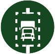
 Narrow Roadway: Limitations by the physical characteristics of the street, such as narrow roadway
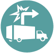
 Difficult Truck Turn: Limitations by the physical characteristics of the street, such as sharp turns
 Maintenance Needed: Substandard road conditions, such as potholes, uneven surfaces, or lack of maintenance.
 Limited Truck Parking: Shortage of designated parking spaces for trucks.
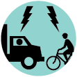
 Observed Bicyclist and Truck Conflict: Observed locations where multiple incidents of bicycle and truck conflicts occurred
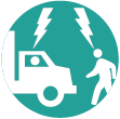
 Observed Pedestrian and Truck Conflict: Observed locations where multiple incidents of pedestrian and truck conflicts occurred
 Speeding Truck: Locations where trucks are observed speeding along the street or intersection
 Health and Environmental Impact: Locations with air quality, general health, and environmental concerns
 Comments (2128)
 Comments (2128)
Several food trucks have been observed idling for more than 20 minutes.
At least once a week, a large truck has difficulty making a turn and blocks traffic on Van Brunt.

The street is way too narrow for 2 way busses, trucks and bike lanes!!! Trucks should not be going down Saint Johns place in the stretch between Roger’s and New York.

Please help! The trucks are tearing up the street. There are giant pot holes and the trucks are so heavy and big they tear up the asphalt so quickly and make deep ridges and holes from the weight. We need to get the trucks off of saint johns place fix the holes and repave. please!
Please help! The trucks are tearing up the street. There are giant pot holes and the trucks are so heavy and big they tear up the asphalt so quickly and make the trolley tracs show through. We need to get the trucks off of saint johns place, remove the trolley tracks and repave. please!
Saint Johns Place is so small with the bus and bikes and tons of kids and families. Giant trucks always use it as a shortcut and it is very dangerous. They can't make the turn from nostrand easily but always try. There are so many accidents here. Please stop trucks from going on Saint Johns Place!

No trucks on Metropolitan Avenue.
Trucks leaving East River Plaza on 117th street do not turn to take 116th (truck route). Signs should indicate they are required to turn to use the larger cross street instead of 117 which is a crowded residential street. I would like to see signage.
Trucks illegally turning onto Ocean Parkway as a shortcut to the Prospect Expressway drive very fast through this intersection making it particularly dangerous for bicyclists coming on and off the bike lane for Ft Hamilton Parkway and Ocean Parkway S Access as well as for pedestrians.
Trucks illegally taking shortcut from Caton to the Prospect make this very dangerous for pedestirans
Do you want to show us the area in StreetView before submitting?

Add comment
Comments should be related to the posted topic or specific project. The Projects and Initiatives website is not meant for comments that do not directly relate to the purpose or topic of the specific project. For general comments or communications concerning an agency, please contact the agency's Commissioner on www.NYC.gov. For service requests, please contact 311 Online.
Pan left or rigth to show the area you wish to comment on.
 Submit comments
 Return to map
To add your comments:
How do you want to submit your comment: