Narrow roadway
The NYC Truck Route Network is a system of designated roads that helps commercial vehicles navigate the city efficiently. It aims to:
Connect primary freight origins and destinations.
Maximize access to industrial and commercial zones.
Minimize conflicts with residential areas and vulnerable road users.
This network is crucial for supporting the local economy and livability by:
Organizing neighborhood truck activity
Reducing traffic congestion on non-designated routes
Feedback Guidance:
We want to hear from you, help us identify how and where we can improve the movement of trucks on our city streets.
Options for feedback:
 Confusing Truck Route Signage: A Unclear or inaccurate posted truck route signage
 Missing Truck Route Signage: A lack of adequate signage to help guide trucks to and along designated truck routes.
 Poor network connection: Areas with inadequate truck route network connectivity, often leading truck drivers to deviate from designated truck routes.
 Weight & Height Restrictions: Overweight and/ or over-dimensional trucks are often observed.
 Limited Curb Access: Trucks observed blocking moving, bike, or bus lanes; or have limited access to curbs for loading and unloading purposes.
 Narrow Roadway: Limitations by the physical characteristics of the street, such as narrow roadway
 Difficult Truck Turn: Limitations by the physical characteristics of the street, such as sharp turns
 Maintenance Needed: Substandard road conditions, such as potholes, uneven surfaces, or lack of maintenance.
 Limited Truck Parking: Shortage of designated parking spaces for trucks.
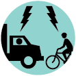
 Observed Bicyclist and Truck Conflict: Observed locations where multiple incidents of bicycle and truck conflicts occurred
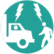
 Observed Pedestrian and Truck Conflict: Observed locations where multiple incidents of pedestrian and truck conflicts occurred
 Speeding Truck: Locations where trucks are observed speeding along the street or intersection
 Health and Environmental Impact: Locations with air quality, general health, and environmental concerns

Narrow roadway

This is a very narrow street with a "sharrow" bike lane that does not provide adequate protection for cyclists from trucks or cars. It is very dangerous for cyclists to maneuver alongside trucks here. Greater physical separation of cyclists and trucks needed.

This is a narrow street with a "sharrow" bike lane that does not provide adequate protection for cyclists from trucks or cars. There is also a playground along the street, and a ferry stop people walk to. Greater physical separation of cyclists and trucks needed.

This is a "sharrow" bike lane that is completely unprotected on this truck route. There needs to be clear separation of bikes and trucks, especially because cars double park on both sides. There is also a bike crossing into the park that has no traffic control devices, which is dangerous for park users and cyclists.

This very active Springfield Gardens warehouse is not within the JFK BID district, and it is not a part of the current trucking route (nor should it be in the future). Yet an active trucking warehouse is embedded here, sandwiched in between several Brookville residential communities. As a result, trucks of all sizes (most notably, 18-wheelers) traverse our narrow residential streets, shaking our homes, spewing toxic tailpipe emissions and sending dust particles into our lungs. They sideswipe our parked cars, pull down our overhead utility lines and damage our roads, adding to our disruption, and posing serious health threats and safety hazards, especially to the children at play. This is clearly not suitable activity for an environmental justice community already plagued by airplane noise and air pollution. One of the biggest problems is the movement of 53-foot/18-wheeler trucks through our local streets. Per section 385 of the Vehicle & Traffic Law (https://www.dot.ny.gov/about-nysdot/faq/are-53-foot-long-trailers-allowed-in-nyc), unless they have special permits, 53-foot trucks are allowed only on routes through NYC to reach destinations in Long Island, using specified connections along I-95, I-295 and I-495; and they are allowed to access JFK Airport via the Van Wyck Expressway. However, they are not allowed to make pickups or deliveries in any of the boroughs of New York City. This means that many of the trucks we see may in fact be illegally traveling on our local streets. But there is no way of knowing or tracking this activity, as there appears to be very little effective coordination of monitoring activity with the NYPD. Local Law 171 requires the DOT to engage with communities to inform the redesign of the truck routes. This should include more than a feedback link on a portal. I implore the agency to engage with local community based organizations (such as the Eastern Queens Alliance, Inc., phone# 347-824-2301) and make arrangements to come into our Southeast Queens communities to hear from local residents and to see how they are being impacted by truck traffic. Finally, please do not use this re-design to extend truck routes into our already burdened communities and please do not allow 53-foot trucks to travel along our NYC streets. Our communities have enough environmental burdens to contend with as is.

The traffic exiting the VN Bridge goes along 92nd St until 7th Ave(Poly Place) where there is a sign for trucks to make a left turn to avoid the residential neighborhood. The sign should be more explicit that all trucks except those making deliveries on Cropsey Ave should make a left turn. Too many trucks are making a right turn and causing congestion on Cropsey Ave.

This is an extremely busy corner with pedestrian traffic to and from schools, playgrounds, and library. The delayed green lights have helped for crossing but cars and trucks routinely create dangerous situations including running lights, blocking crosswalks, intimidating pedestrians, to make the left turn from E 5th and traveling down Caton. There are so many trucks and the traffic is often bumper to bumper which leads to box blocking and more aggressive driving. It's a real hazard and multiple times I have been almost hit while crossing with the right of way on foot.

No bike lane

High truck emissions in this area

The intersection of Church and McDonald is a mess. With the bus route and the tightness of the street I wonder if Church should remain a bus route? Especially with such a big gap between Church and Kings Highway for east/west access. Thanks!
Comments should be related to the posted topic or specific project. The Projects and Initiatives website is not meant for comments that do not directly relate to the purpose or topic of the specific project. For general comments or communications concerning an agency, please contact the agency's Commissioner on www.NYC.gov. For service requests, please contact 311 Online.
Pan left or rigth to show the area you wish to comment on.
To add your comments:
How do you want to submit your comment: