Study Context
Red Hook is experiencing significant land use changes, largely influenced by the growing e-commerce industry. As a waterfront area with historical industrial uses, the area has become a primary location for the placement of last-mile warehouses. The presence of IKEA, the cruise terminal, a UPS distribution center, and the PANYNJ container port already generate significant trips (vehicular and truck) in Red Hook, especially truck traffic bringing and distributing goods for local delivery. The MPO’s Regional Transportation (NYMTC’s 2050) Plan has identified Red Hook as a Coordinated Development Emphasis Area which will facilitate undertaking of the study.
For several years Red Hook residents and elected officials raised concerns related to truck traffic, safety for all modes and structural damage to residences. Red Hook residents have been particularly concerned about heavy truck traffic on corridors with residential use such as Van Brunt, Columbia, and Lorraine Streets.
From a land-use perspective this waterfront area with historical industrial and manufacturing uses has become a central location for the placement of fulfillment centers or last-mile warehouses and similar uses. The proliferation of last-mile fulfillment centers (operated by Amazon, UPS, etc.) in Red Hook have resulted in concerns about mobility, safety for cyclists and pedestrians, as well as quality of life issues. Elected officials, Community Board 6, and other stakeholders have requested a comprehensive traffic study of the area that also looks at warehouse and Industrial Business Zone (IBZ) activity related to last mile delivery by Amazon, UPS etc. as well as the revitalization of the area.
It is in this context NYCDOT is proposing a study that comprehensively examines traffic and truck issues in the neighborhood and assesses the dynamics of placing e-commerce distribution warehouses in neighborhoods with significant residential use. The study will focus on truck traffic, truck signage, safety, and traffic operation. It will also give consideration to land use, environmental justice and transit service/provision. It will build on and coordinate with other DOT studies/initiatives such as the Red Hook Truck Study (2004) that examined truck traffic impact on residential uses and alternative truck access; DOT’s strategic freight plan, the Smart Truck Management Plan, which outlines a roadmap for achieving safe, sustainable, equitable, and efficient last mile freight deliveries. It also provides key strategies and actions to reform and enhance existing freight demand management, truck safety along with compliance programs and policies.
It would complement the New York City Streets Plan by examining ways to accomplish efficient movement of goods and services while ensuring the safe interaction of pedestrians, cyclists, buses, cars, and trucks.
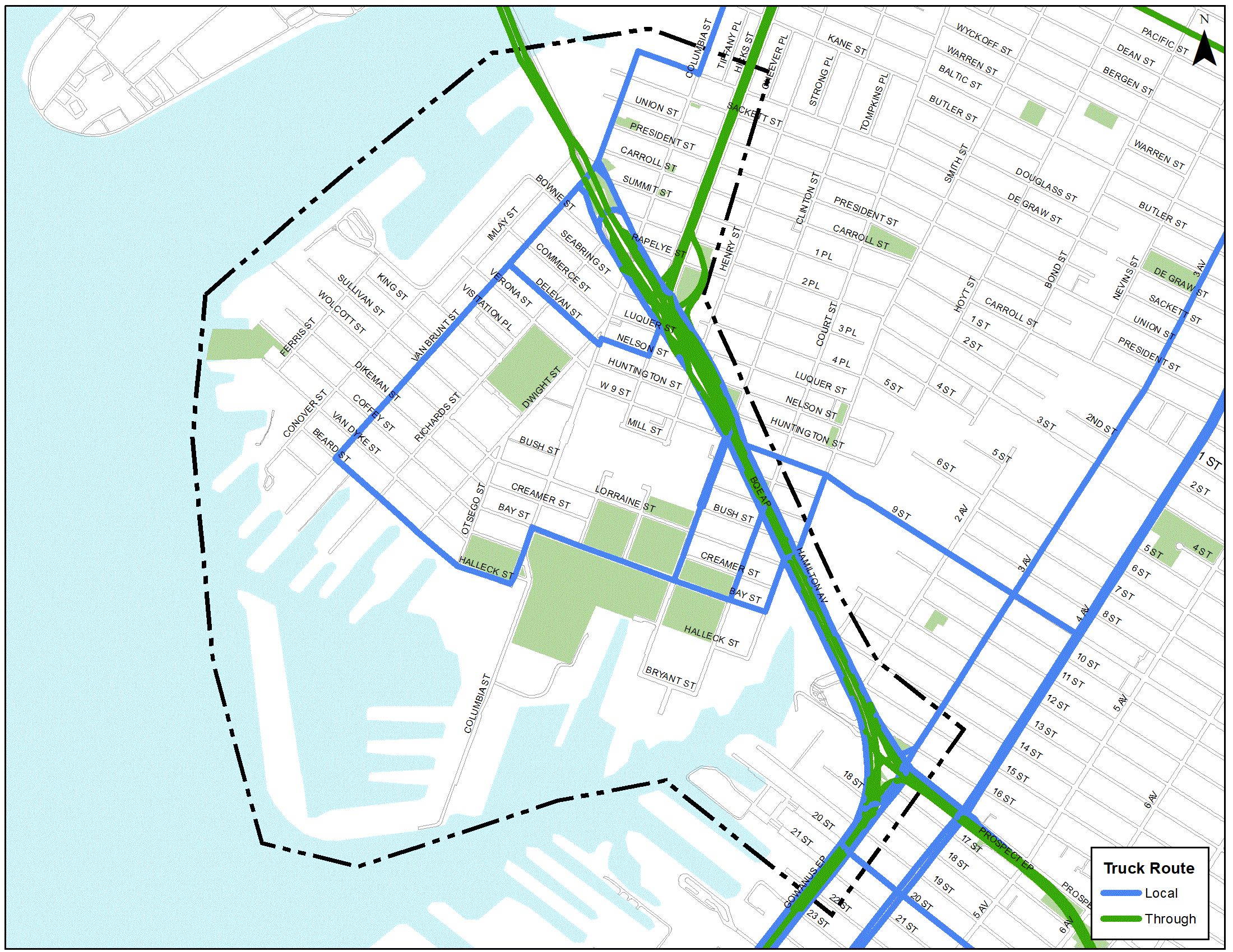
Proposed Study Area
The proposed approximately 1.2 sq-miles study area is bounded by: Buttermilk Channel/Degraw Street to the North, Gowanus Bay/19th Street/3rd Avenue to the South, Red Hook Channel to the West and Hamilton Avenue/Brooklyn-Queens Expressway to the East. See the map below.