
Queens Waterfront Greenway - Public Outreach Events Recap
Events are listed from most recent to least recent.
Open House Events: Implementation Plan Preview (May-June 2026)
The New York City Department of Transportation (NYC DOT) hosted the third and final round of Queens Waterfront Greenway engagement as the city developed an implementation plan for the 16-mile cycling and walking route from Gantry Plaza State Park to Fort Totten. As the culmination of more than two years of community engagement and planning alongside New York City Parks & Recreation and the Economic Development Corporation, NYC DOT unveiled the full proposed route as well as a series of projects for the greenway. The events consisted of a brief presentation followed by an open house where participants discussed greenway projects and prioritization with NYC DOT planners. All events covered the entire length of the greenway.
Events were held:
- May 28, 2026: Jacob Riis Neighborhood Settlement
- June 3, 2026: Louis Armstrong House Museum
- June 9, 2026: Glow Cultural Center
You can view the presentation from all three events here.
Queens Waterfront Greenway Public Workshops: Route Alternatives (February 2026)
NYC DOT hosted a second round of public workshops regarding the Queens Waterfront Greenway Implementation Plan. During this round, planners and community members discussed potential route alternatives throughout the 16-mile geography.
- CANCELLED DUE TO INCLEMENT WEATHER: February 24, 2026: Glow Cultural Center (project area: Willets Point to Fort Totten)
- February 26, 2026: virtually (project area: full geography, with emphasis on eastern Queens routes - Gantry Plaza State Park to Fort Totten). View the presentation here.
- The first workshop focused on the area connecting Bowery Bay/LaGuardia Airport to Willets Point. View the presentation here.
- The second workshop covered western Queens from Gantry Plaza State Park to Bowery Bay/LaGuardia Airport. View the presentation here.
Queens Waterfront Greenway Public Workshops: Existing Conditions (October 2024-January 2025)
NYC DOT hosted its first round of public workshops on the Queens Waterfront Greenway Implementation Plan in October 2024.
Each workshop collected community feedback within specific geographic areas:
- October 8, 2024: Bohemian Beer Hall (project area: Gantry Plaza State Park to Bowery Bay) View the presentation from the October 8 workshop.
- October 16, 2024: Glow Cultural Center (project area: Bowery Bay to Willets Point) View the presentation from the October 16 workshop.
- October 24, 2024: Alley Pond Park Environmental Center (project area: Willets Point to Fort Totten). View the presentation from the October 24 workshop.
- January 28, 2025: virtually (project area: entire geography)
Project Background
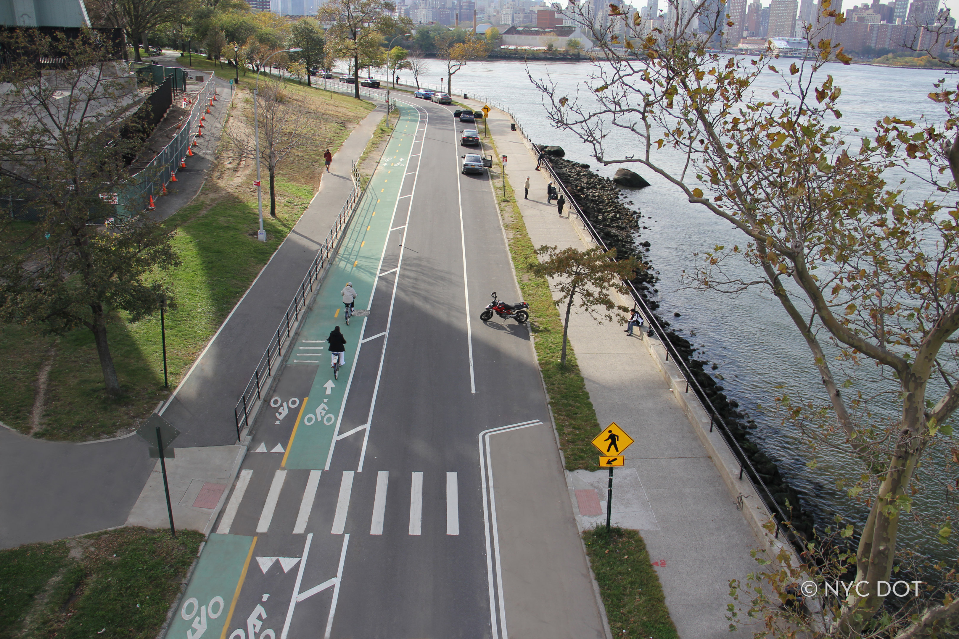
New York City Department of Transportation (NYC DOT), in partnership with the Department of Parks and Recreation (DPR) and the NYC Economic Development Corporation (EDC), launched a community-based process to develop a plan for closing the gaps in current bike and pedestrian infrastructure to make it easier for residents to access parkland and waterways. When complete, this new portion of the Queens Waterfront Greenway will constitute a continuous 16-mile corridor connecting Gantry Plaza State Park to Astoria Park along the East River and to Fort Totten following the Long Island Sound.
By many metrics Queens is the most ethnically diverse place on Earth. Its built environment is likewise varied, with low-density suburbs abutting rowhomes and large high-rise apartment complexes. Recently, Western Queens has benefitted from public and private investment in both housing and waterfront amenities along the East River, including five miles of two-way bike path along Vernon Boulevard, completed in 2013. Civic institutions and services—including major airports, miles of public beaches, sports stadiums, and the historic 1964 World’s Fair—have made the borough a popular place to live.
However, because the borough was developed in the 20th century as a commuter community for Manhattan workers, Queens suffers from gaps in intra-borough public transit service. Car-centric planning resulted in large freeways, creating an unwelcoming environment for pedestrians and bicyclists attempting to cross neighborhood boundaries. Though the borough holds 3,000 acres of parkland, it's unevenly concentrated in central Queens. By connecting parks, greenspace, and outdoor recreation, the Queens Waterfront Greenway will better link Queens residents to waterfront open space.
Implementation Plan
-
The Queens Waterfront Greenway Implementation Plan outlines a comprehensive strategy to create a continuous and accessible path by identifying a series of short-term and long-term projects.
-
NYC DOT has worked with--and continues to work with--community members to identify and address high-priority gaps with Street Improvement Projects while simultaneously building support for larger capital projects and momentum to realize the entire plan.